Still deep in Aragón’s alpine heart, these days take you into the true high Pyrenees — a world of outrageous elevation gains, steep descents, and crossings above 3,000 metres. Expect long, punishing days, moments of pure exhilaration, and scenery on a scale that defies photographs.
After a 50 km detour to avoid a dangerous section in poor weather, Jakub and I finally rejoined the GR11 at the head of the Ordesa Valley. From here, we worked our way towards Benasque, following Stages 17 to 20 in the Cicerone Guide. Along the way, we made side trips in hopes of climbing some of the range’s highest peaks — which meant we were far from the fastest.
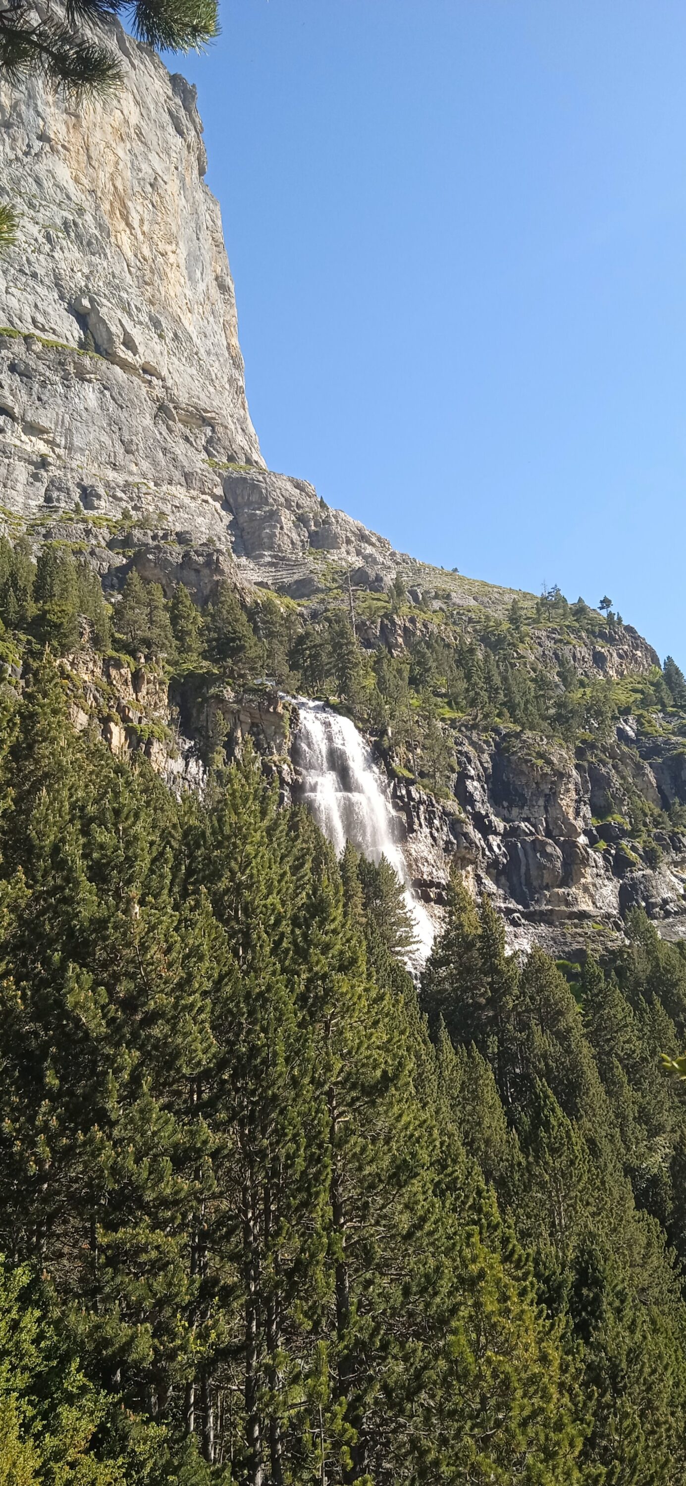
These stages took us past waterfalls and alpine lakes, over 3,000 m cols, and down endless descents into deep valleys. We battled fatigue, dodged storms, and camped in spectacular high-mountain settings. We also learned the hard way that in this terrain, “good conditions” is a relative term — and proper equipment is not optional.
Key Notes for the High Pyrenees:
- Both Monte Perdido and Pico de Posets can be climbed on variants through this section, but you must carry and know how to use ice axes and crampons.
- Expect over a thousand metre elevation days — both up and down — with little respite.
- Afternoon storms are common; plan early starts.
- High passes often hold snow into summer.
23/06 – Monte Perdido… or Not
I woke early with that delicious mix of excitement and anticipation — today, we’d try to climb Monte Perdido. Nestled in Ordesa y Monte Perdido National Park, Perdido rises to 3,328 metres, making it the third-highest peak in the Pyrenees. Interestingly, it’s also the tallest limestone mountain in all of Europe.
I hired an ice axe from Refugio de Góriz and asked the guardian about conditions:
Me: “How are the conditions? Is it okay in micro spikes?”
Guardian: “Conditions are good… but it depends on experience.”
Not exactly definitive. Still, Jakub and I decided to chance it with snow spikes. In hindsight, not the best decision.
After a good breakfast, we set off later than planned — but with no big packs, we moved quickly, overtaking many of the early starters. What a joy to walk without a heavy rucksack. From Góriz at 2,160 m, we hiked and scrambled up to the final rock ridge before the snowline, around 3,000 m.


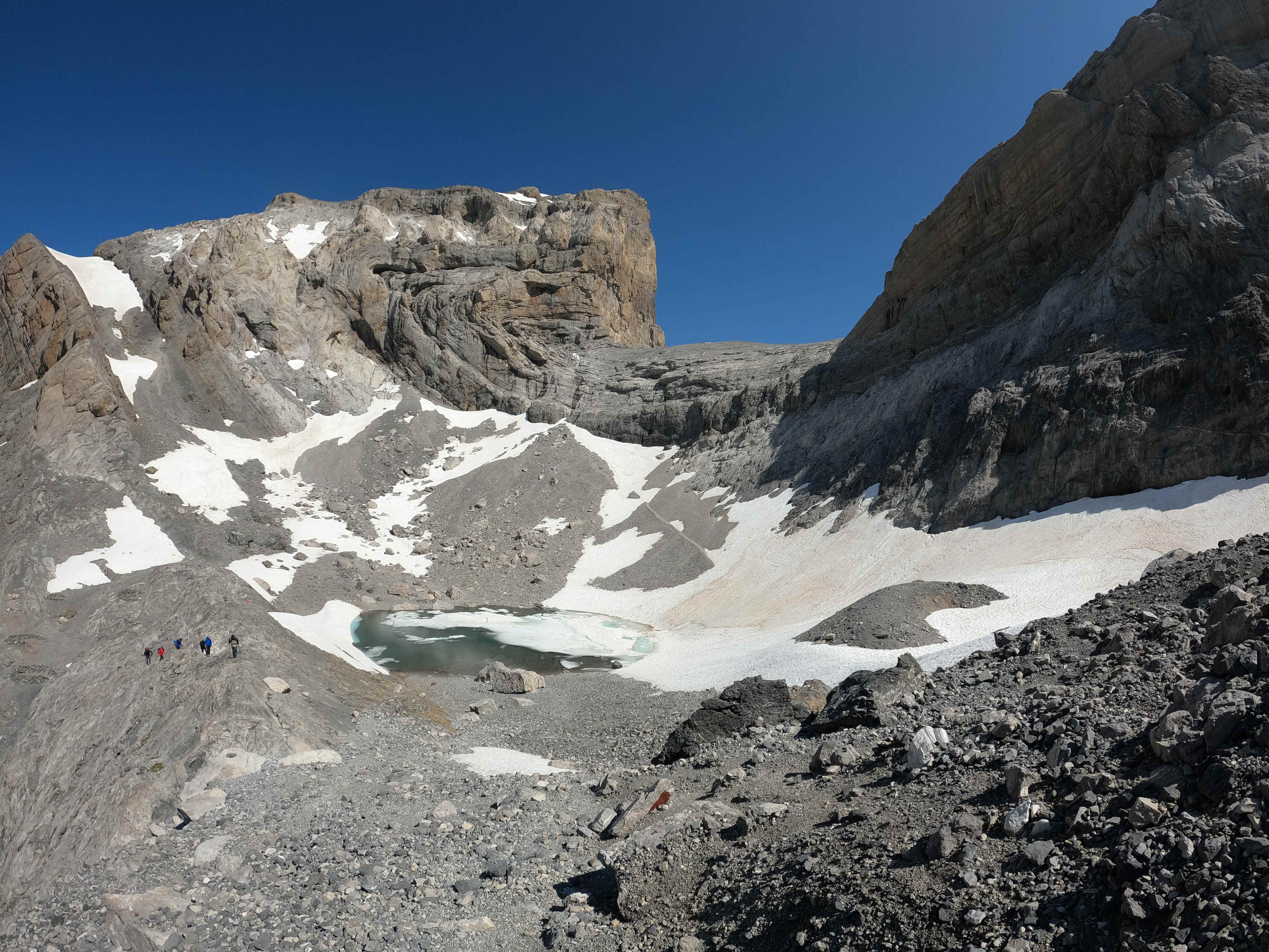
Here, our summit bid ended. The final 100 metres climbed a steep snow slope of over 60°. I watched two climbers in crampons front-point their way up the bullet-hard snow. Our micro spikes didn’t have front points — and without them, the descent would have been dangerous. The consequence of a slip here was unthinkable.

A little disappointed but confident we’d made the right call, we turned back to Góriz. When we returned the ice axes, the guardian asked:
Guardian: “Did you summit?”
Me: “No, micro spikes weren’t suitable.”
Guardian: “No, of course you need crampons.”
If only he’d said that this morning! Still, it was our decision to try, and our decision to turn around. The mountain will always be there.
We spent the afternoon resting instead — not quite the summit day I’d envisioned, but a safe one.
24/06 – Refugio de Góriz to Wild Camp past Refugio de Pineta
1,000 metres up.
2,000 metres down.
Horrendous.
The night before, I met a fellow camper from Bristol — proof, once again, that Bristolians get everywhere.
This stage offers two options: the old route, which traverses an exposed section, and the new route, which adds more elevation gain and loss but avoids the exposure. After our retreat from Monte Perdido the day before, Jakub and I chose the safer (if more punishing) new route.
The day began with an 800-metre descent. At times, it felt like we were walking directly toward a cliff, only for a narrow way down to suddenly reveal itself. Near the end of this descent, I went off-route and found myself wading through thigh-high stinging nettles — in shorts. That sucked.
Next came a long, hot 1,000-metre climb. It was relentless, but we did find salvation in several ice-cold stream pools, perfect for a quick swim to freshen up. Sadly, the freshness didn’t last long — before we knew it, we were sweaty and slogging again.

We reached the top around 13:00 and took a well-earned rest before beginning the real challenge: a 1,200-metre descent over just 3–3.5 km. The upper section was steep, loose scree, but it eventually gave way to a well-defined trail winding through woodland, complete with bouldery steps that tested already tired legs.
After two and a half hours of continuous descent, I heard cowbells echoing in the valley and, in my exhausted state, thought I might have died and gone to purgatory — doomed to descend forever. Thankfully, it ended. We finally reached the bottom, crossed a couple of rivers (boots off), and arrived at Refugio de Pineta for a much-needed pint.

From there, it was another 30 minutes to the Parador de Bielsa Hotel… which wasn’t serving food. Darn.
The final 30–40 minutes nearly finished me off. I’d run out of energy completely — to borrow a running term, I bonked. The last 10 minutes felt like an eternity as I dragged myself to the unmanned hut. Unfortunately, a French hiker beat us to it, so we pitched our tents in the animal coop out back. I cooked an absurdly large pot of pasta and then collapsed into a deep, dreamless sleep.
25/06 – Near Refugio de Pineta to “Dungeon” Bothy
My legs felt like stone today. The ascent to Collata las Ciribetas (2,159 m) was harder than it should have been, even though the terrain wasn’t especially challenging. At least it was beautiful.
For the first time, I saw a group of Griffon Vultures on the ground. At first, I couldn’t work out what they were — they lurched and lumbered about so awkwardly compared to the effortless grace they show in the air. Enormous birds, but slightly comical when running.
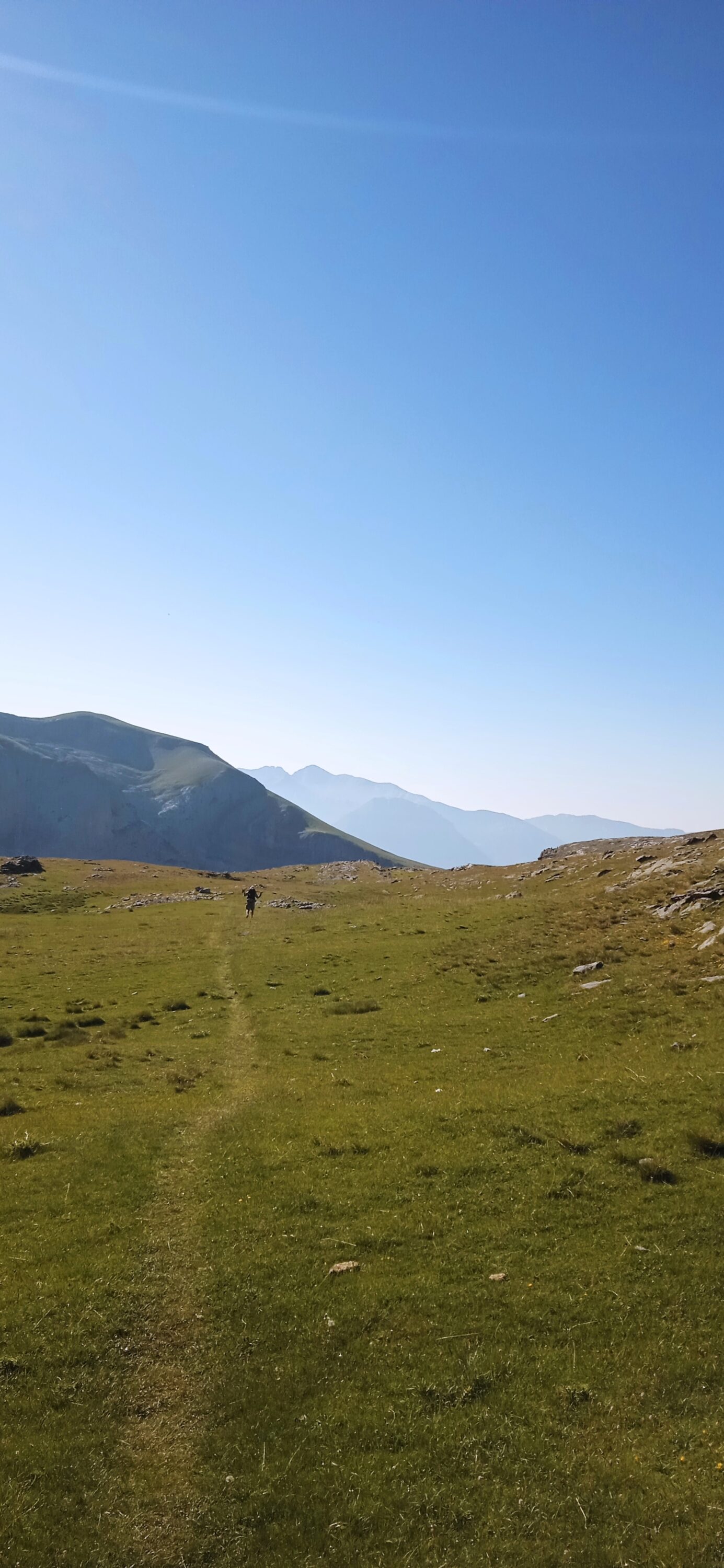
From the high point, the descent to Parzán was long, hot, and fairly dull — though the cherry trees lining the trail made for excellent snacking.
In Parzán, we restocked at the supermarket, then had a big lunch at a roadside restaurant. I met Thomas from the Netherlands, who was walking the HRP — the third Dutch hiker I’ve met doing that route!
From Parzán, the trail climbed again, following a wide forestry track. It was another long, uninspiring section — and now uphill, in the afternoon heat. After three and a half sweaty hours, we reached the unmanned bothy near the hydro-electric plant. The place felt a bit like a dungeon — no windows, dark and unwelcoming — but it would do for the night.

Luckily, there was a stream nearby to wash off the day’s sweat (above the hydro plant, not below!).
At this point, I was seriously ready for a rest day. I’ve been pushing since Ochagavíaon the 19th — and my legs are reminding me I’m not twenty anymore
26/06 – Dungeon Bothy to Ibón Llardaneta
We were both more than happy to leave the dungeon behind. Less than an hour later, we passed another hut — this one much nicer, with a spectacular view. Bother. Still, at least the dungeon was only for one night.
From there, it was a tiring climb to Collata Chirau (2,364 m). My legs were heavy, and the trail — while scenic in parts — was fairly straightforward and unremarkable until we reached Refugio de Biadós.
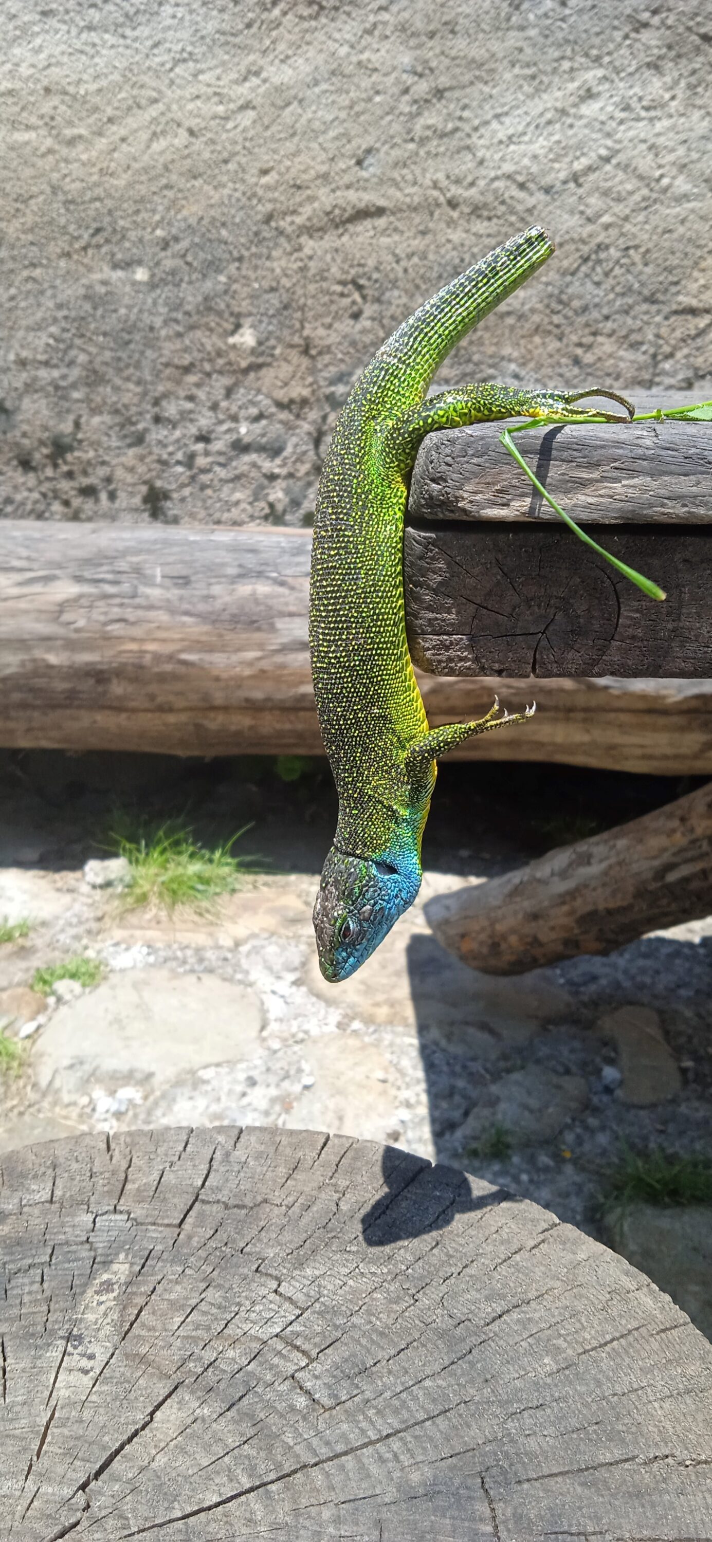
We arrived at midday and decided to linger for a couple of hours to avoid the worst of the heat. While there, I rescued a bright green lizard with a blue chin from the clutches of a cat that was more than happy to torment it. The poor creature sat motionless for nearly an hour, recovering from shock, before vanishing back into the wild — hopefully to live a long, torment-free life.

From Biadós, the trail splits: either a long 21 km push to Puente de San Chaime, or a two-day variant around the Posets massif. Since Jakub and I were keen to climb Pico de Posets (3,369 m), we shouldered our packs and began the variant.
The first stage involves a gruelling 1,200 m of ascent. It began gently enough on woodland paths, but soon steepened, climbing directly up a thin mountain track.

At Collada Eriste (2,864 m), I wound my way through a boulder field, crossed snow-covered scree, and finally descended to Ibón Llardaneta (2,700 m).
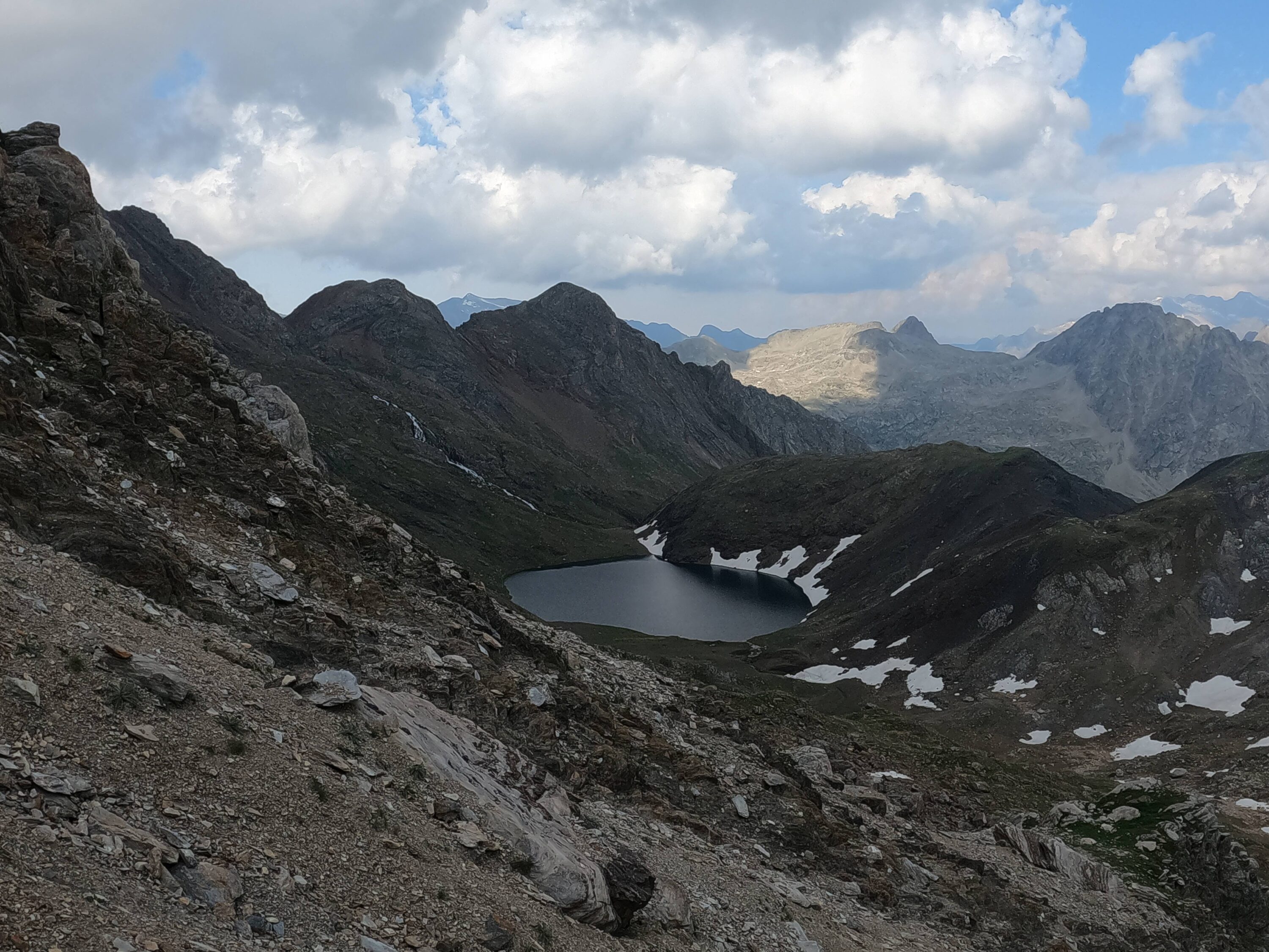
Behind a large boulder, someone had built a stone circle — perfect for pitching the tent. I braved the frigid waters to freshen up before settling in for the evening.
What a camp. No one else around, a pristine alpine lake, and panoramic mountain views. Marmots shuffled about, sounding their sharp, shrill calls into the stillness. A perfect end to a hard day.


27/06 – Ibón Llardaneta to Benasque
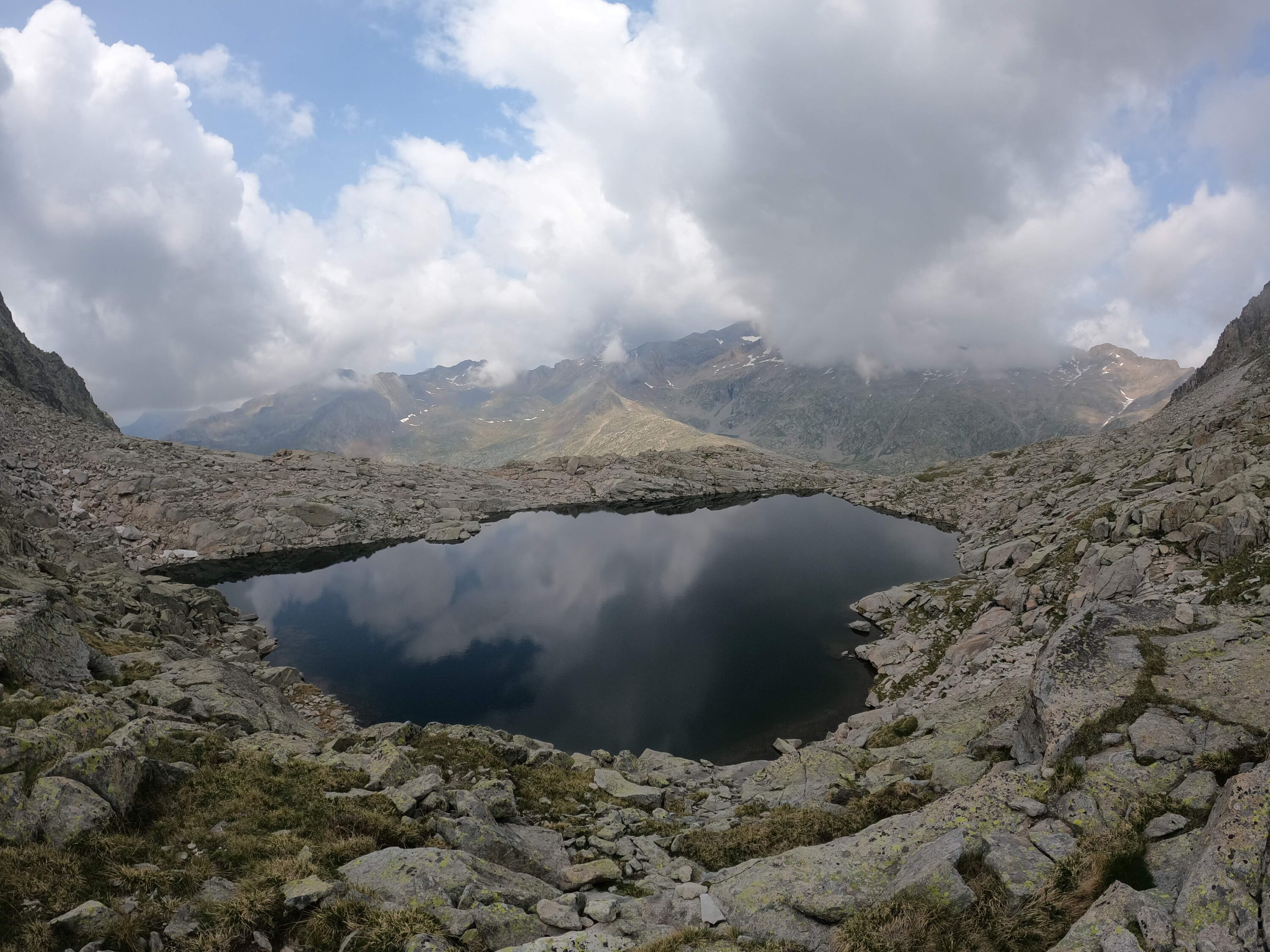
After a chilly but comfortable night at 2,700 m — still within the snowline — we woke early, ready to attempt Pico de Posets before completing the second day of the variant. From camp, the trail was snow-free until about 3,000 m.
Without a guardian to ask about conditions, we were cautious. Then, from around a bend above us, a trail runner appeared.
Me: “How are the conditions?”
Runner: “With crampons it is fine.”
Me: “With microspikes?”
[Unconvincing shrug] — the sort of shrug that clearly meant, I wouldn’t.
That was enough for us. No summit today.
We rejoined the GR11, passing a string of spectacular alpine lakes. Honestly, I think we were both secretly relieved not to push for the summit — our legs were shot, and we badly needed a rest.

For reasons still unknown, nearly every señorita we passed seemed to be walking the opposite direction, which we found oddly amusing.


After a couple more hours, the trail transitioned from the beautiful high ground into lower, less alpine terrain, eventually reaching Puente de San Chaime. There, we stayed at Aneto Camping. It was a bit overpriced, but a perfectly nice place to rest and regroup.
28/06 – Rest Day, Hurrah!
We kicked things off with an excellent lunch before heading into Benasque to resupply. Hitchhiking down to the town was easy enough — getting back, not so much.
Then, something bizarre happened. A car drove past, full of a family. It went around the bend, then stopped, turned around, and came back. In my best bad Spanish, I explained we were staying at Aneto Camping. I expected the driver might take one of us and return for the other.
Instead, after a brief exchange inside the car, the driver’s daughter got out, gestured for us to get in, and waved us off. Slightly stunned, we hopped in, and the man drove us straight to the campsite. I can only assume he went back to collect his daughter afterwards.
That evening marked the end of this stretch together for Jakub and me. He wanted to push on at a faster pace, while I had mountains in mind to climb.
Adiós, amigo. Well… after a few farewell beers, of course.

